Dispatch anywhere with IncidentCAD
Enterprise-grade CAD — no big budget or IT staff required.
Who IncidentCAD Is Built For
Whether you coordinate a weekend festival, run a volunteer fire department, or manage a private dispatch operation, IncidentCAD gives you professional-grade dispatch without the complexity or cost.
Small Events
Concerts, races, fairs, and community gatherings. Set up dispatch in minutes, coordinate medical and security teams in real time, and tear down when the event ends.
Emergency Response
Volunteer fire, EMS squads, and non-profit disaster teams. Reliable 24/7 dispatching that reduces errors in high-stress environments with minimal training required.
911 Operations
Small municipalities and PSAPs that need a modern CAD without six-figure contracts. Fast dispatch workflows designed to reduce response times and save lives.
Private Dispatch
Tow companies, facilities management, and security teams. Track units, assign jobs, and coordinate field resources with the same tools used by public safety agencies.
About IncidentCAD
IncidentCAD is a cloud-based computer aided dispatch system built for agencies that need reliability, flexibility, and modern technology.
Our platform includes Dispatch, Mapping, Mobile CAD, and Reporting with real-time GPS tracking for field resources. Designed specifically for communications centers that require both tactical flexibility and rock-solid availability during unexpected situations.
Whether you're running 911 operations, managing special events, or coordinating emergency response, IncidentCAD delivers a seamless experience backed by enterprise-grade infrastructure and the latest cloud technology.
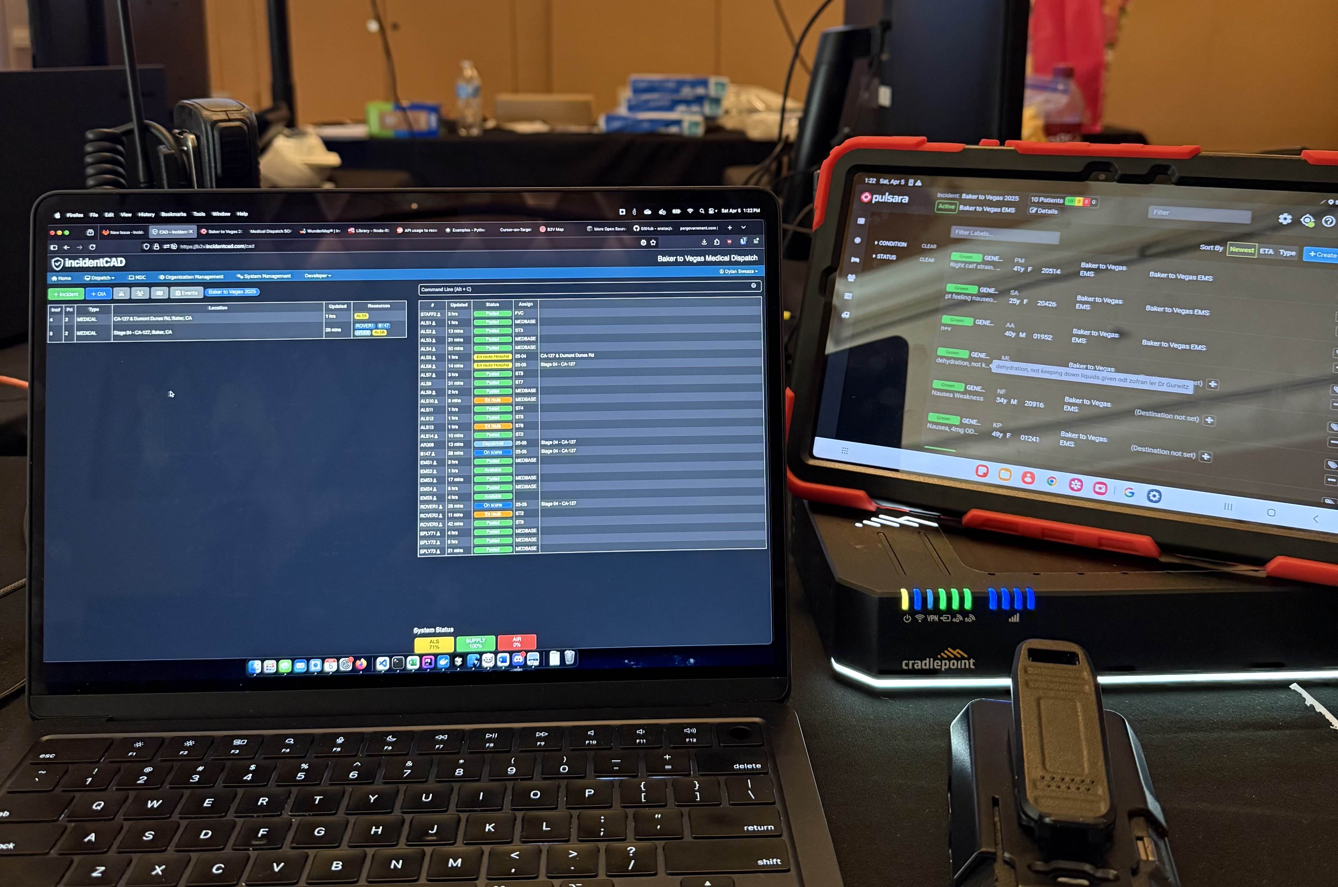
Baker to Vegas Challenge Cup Relay Race trusts IncidentCAD to coordinate dispatch operations across 120 miles of desert. With 5,000 runners, 20 ambulances, and multi-agency teams, IncidentCAD tracks incidents, resources, and real-time status updates throughout the night. Read the full case study.
Features That Drive Results
Every feature is designed to reduce response times, simplify coordination for small teams, and cut training time and errors.
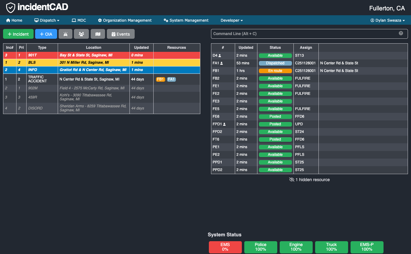
Dispatch
Our intuitive dispatch board lets your team manage resources, create calls for service, and dispatch units in seconds — not minutes. Fewer clicks mean faster response times and fewer errors under pressure.
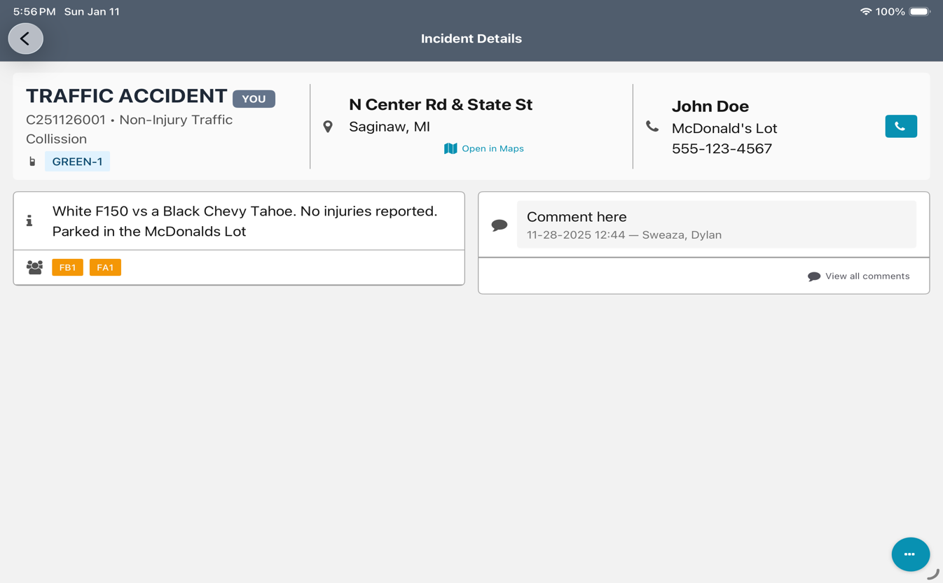
Mobile
Field responders view calls, update status, and check maps from any device — Web, iOS, or Android. Small teams stay coordinated without radio bottlenecks, so nothing falls through the cracks.
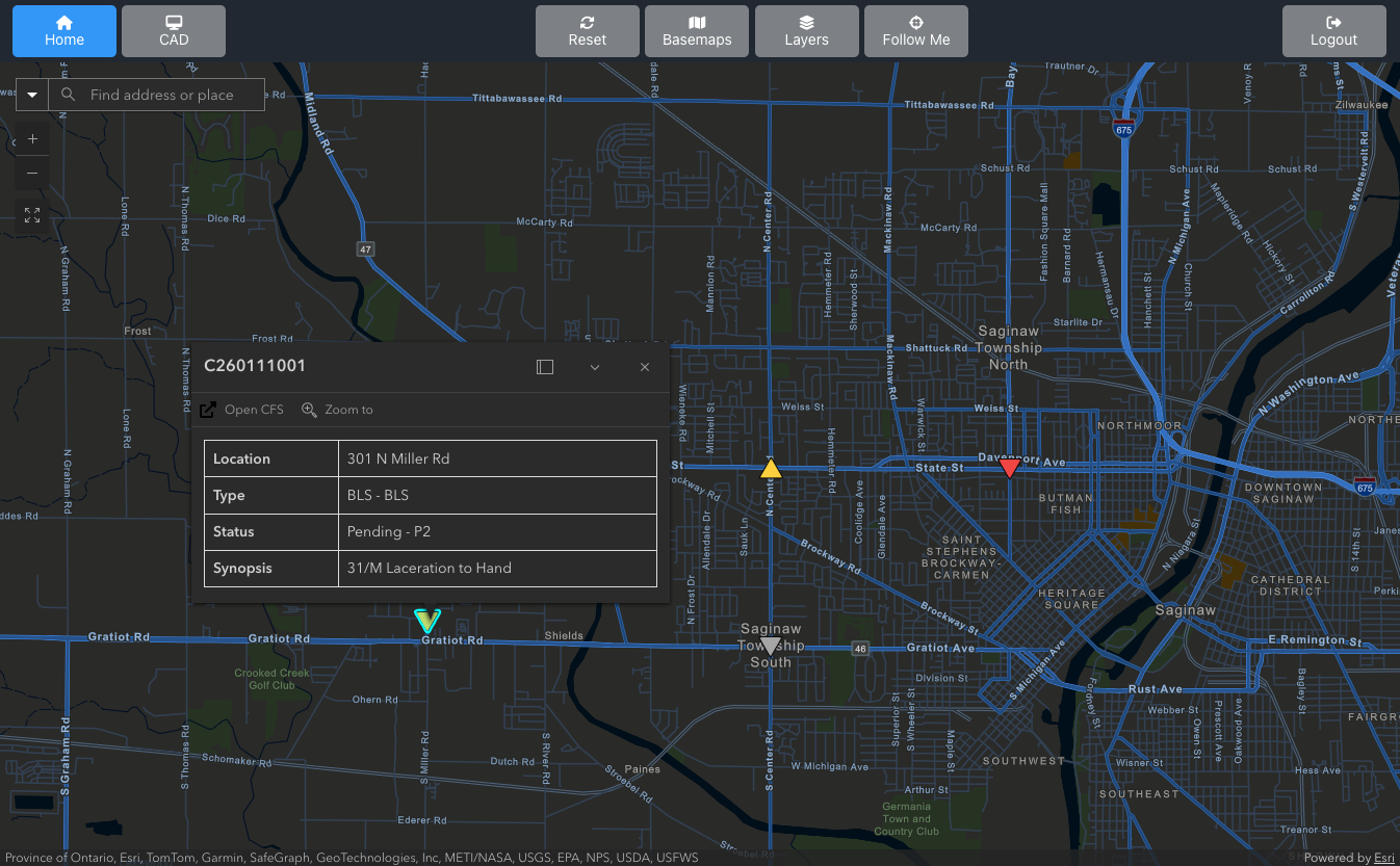
Mapping
ESRI ArcGIS-powered maps show resources, calls, and key locations in real time. Dispatchers see the full picture instantly, helping reduce response times by routing the nearest available unit.
Which Plan Fits You?
Transparent pricing so you can plan your budget before your first call. Every plan includes Dispatch, Mobile, Mapping, and Reporting.
Plans starting at $15/user/mo
Starter
For small and volunteer departments that need a reliable, modern dispatch platform without the overhead. Everything you need to run calls, track resources, and keep your team connected.
Professional
For career departments and growing agencies that need deeper integrations, SMS paging, single sign-on, and API access to connect with existing systems. Includes priority support.
Enterprise
For large agencies and county/regional operations managing multiple departments. AI-enhanced data and recommendations to support first responders, cross-org resource sharing, CJIS-compliant hosting, and dedicated support.
Event / Standby Plan
Starting at $2,000/yr
For incident management teams, search and rescue, event medical, and other organizations that mobilize on demand. Stay provisioned year-round, activate instantly when needed, and only pay for the days you're operational. Unlimited users during activation.
Get in Touch
Ready to modernize your dispatch operations? Schedule a demo or ask us anything about IncidentCAD.